


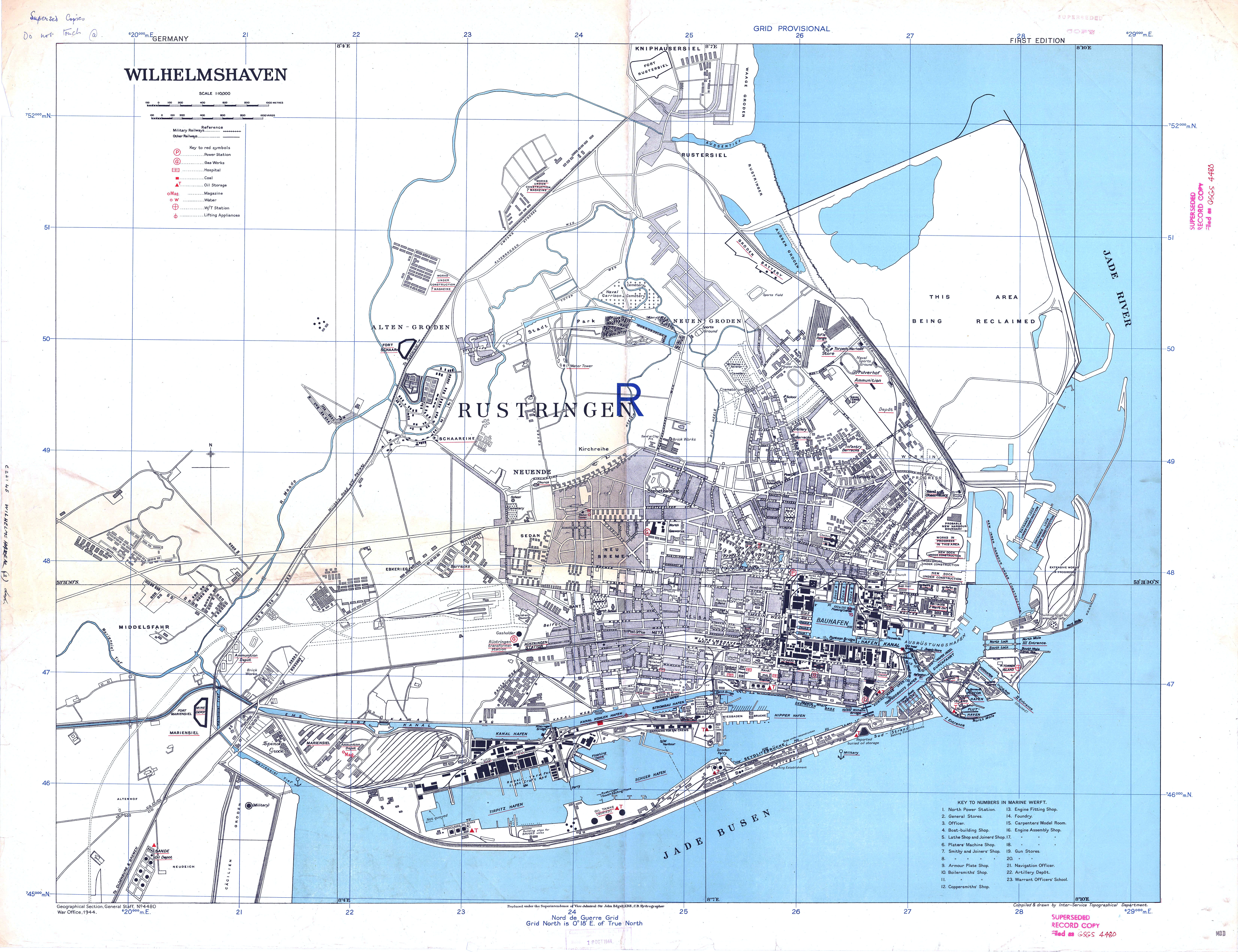
| map file | GSGS_4480_GERMANY_WILHELMSHAVEN_10K_1st_ed_1944_bl.jpg |
|---|---|
| file size | 6012541 (5.7 MB) |
| sheet number | Wilhelmshaven |
| map sheet scale | 1:10,000 |
| sheet title | WILHELMSHAVEN |
| publication year | 1944 |
| publisher | Geographical Section, General Staff (Wielka Brytania) (opracowanie: Wojskowy Instytut Geograficzny) (Geographical Section, General Staff (Great Britain) (elaborated by: Wojskowy Instytut Geograficzny)) |
| map/scan condition | bad |
| scan resolution | 150 dpi |
| scan colors | rgb |
| file added | 2020-08-17 |
| entry edited | 2020-08-17 16:44:03 |
| from the collection of | British Library, London |
