


| Kartedatei | NOUVEAU_PLAN_DE_GIBRALTAR_1727_RM.24632.jpg |
|---|---|
| Dateigröße | 5735484 (5.5 MB) |
| Blattnummer | Eur-Iberian |
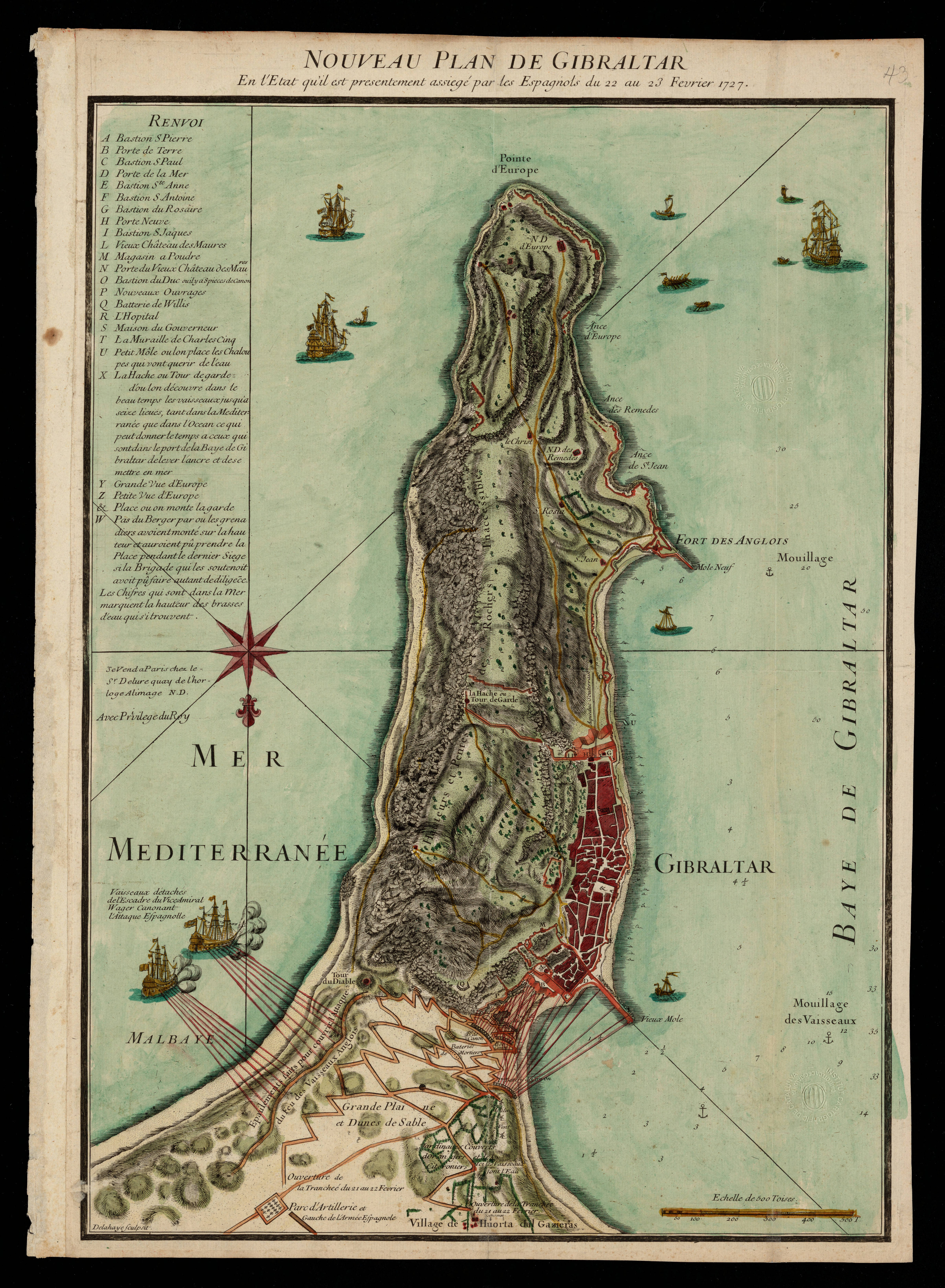
| Blatttitel | NOUVEAU PLAN DE GIBRALTAR |
| Veröffentlichungsjahr | 1727 |
| Karte/Scanzustand | gut |
| Scanauflösung | 300 dpi |
| Scanfarben | rgb |
| Datei hinzugefügt | 2020-09-12 |
| Eintrag editiert | 2020-09-12 18:54:50 |
| aus der Sammlung von | Institut Cartogràfic de Catalunya |
| RM.24632 |
