


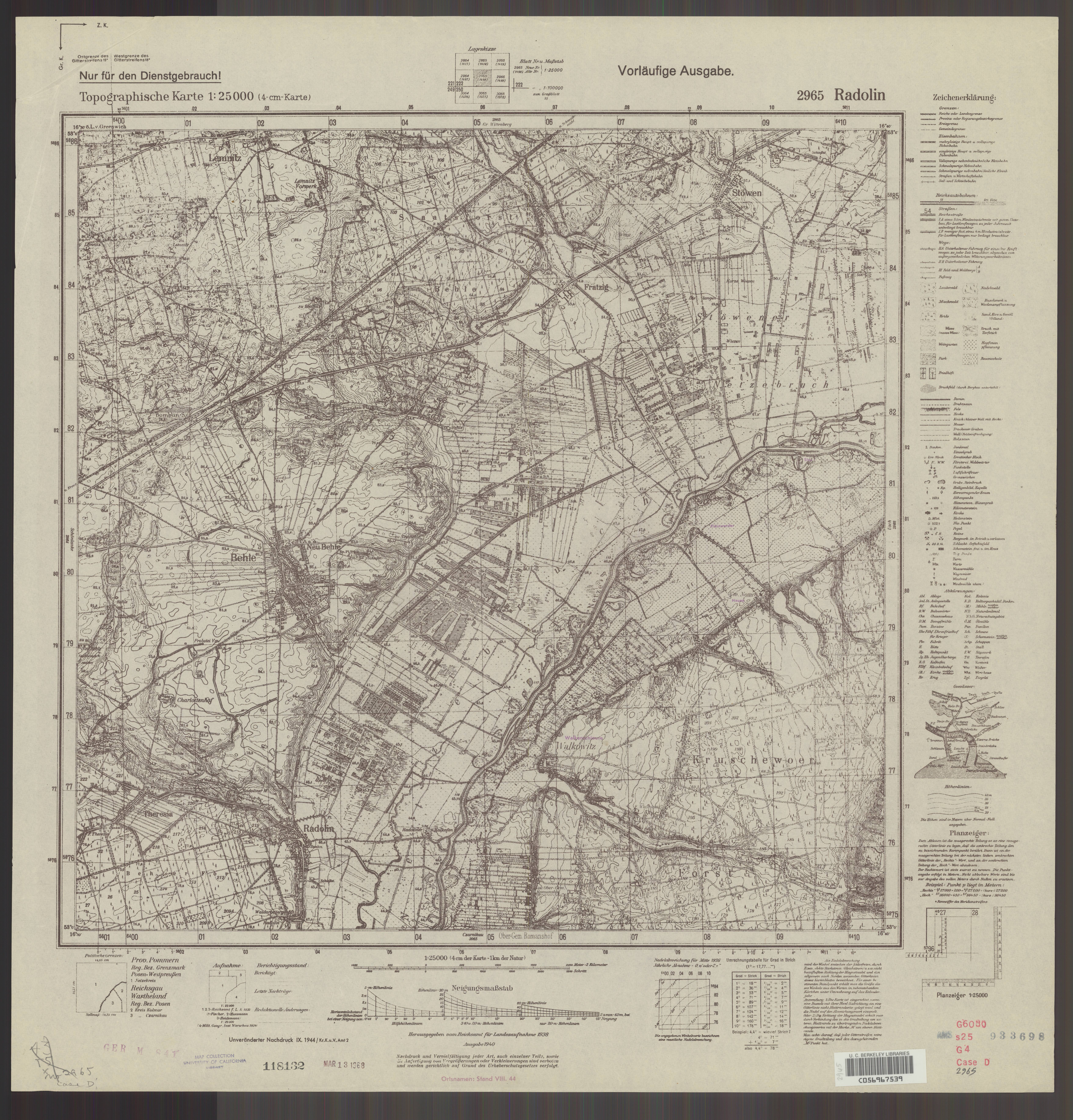
| map file | 2965_Radolin_IX.1944_uniberk_C056967539.jpg |
|---|---|
| file size | 7052728 (6.7 MB) |
| sheet number | 2965 (1498) |
| map sheet scale | 1:25,000 |
| sheet title | Radolin |
| publication year | 1944 |
| publisher | Oberkommando des Heeres / Generalstab |
| scan resolution | 300 dpi |
| scan colors | rgb |
| file added | 2020-10-12 |
| entry edited | 2020-10-12 16:43:32 |
| from the collection of | The University of California Berkeley Library |
| call no | dl id: C056967539 |
