


| plik mapy | 10.109_E.BOUNDARY_POLAND_86_LWOW_nara_1946_305945_10109_01.jpg |
|---|---|
| rozmiar pliku | 7854719 (7.5 MB) |
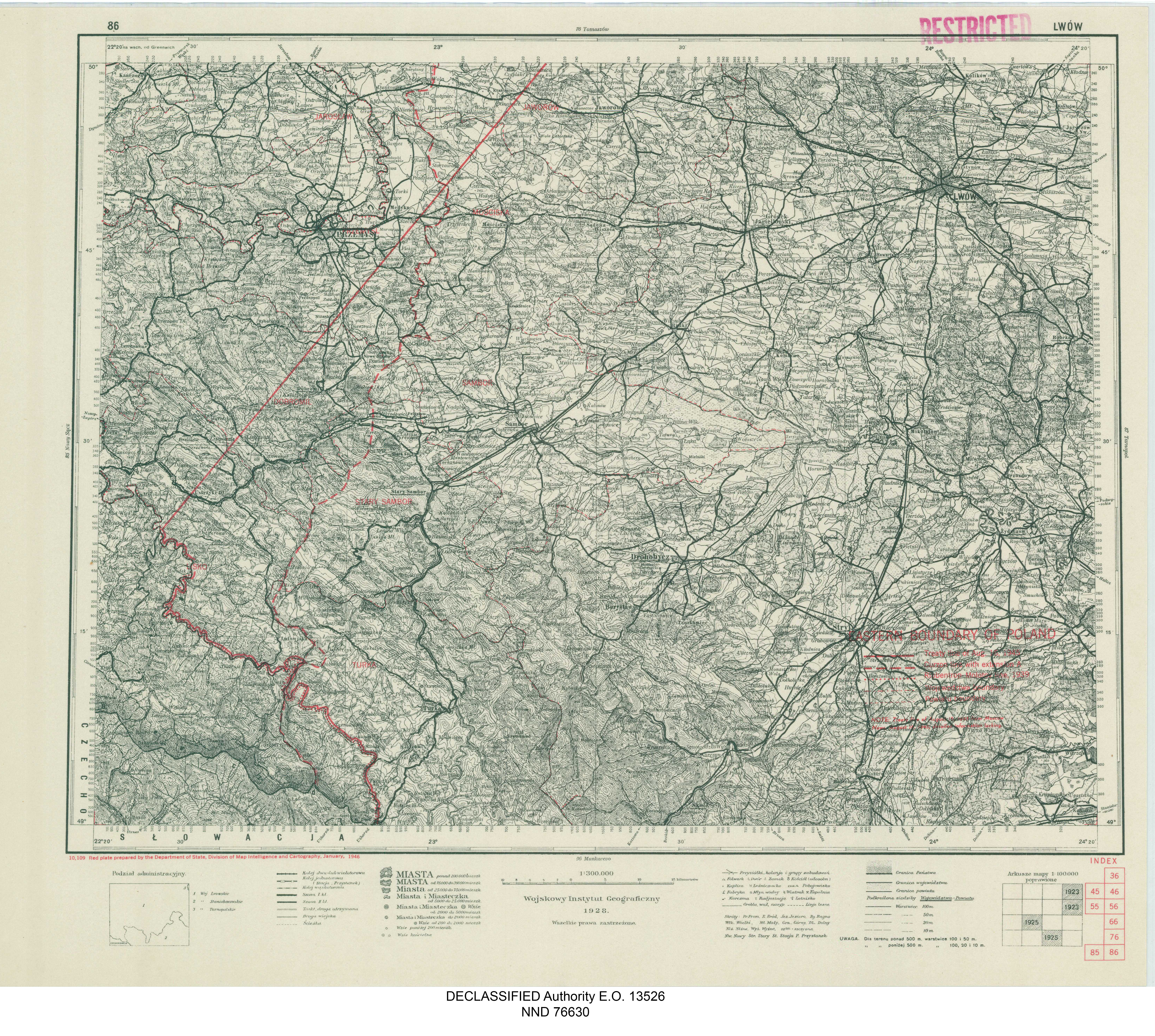
| godło arkusza | 86 |
| skala arkusza | 1:300 000 |
| tytuł arkusza | EASTERN BOUNDARY OF POLAND - 86 LWÓW |
| adnotacja | Treaty line of August 16, 1945; detailed information lacking |
| rok wydania | 1946 |
| wydawca | Department of State, Division of Map Intelligence and Cartography |
| stan mapy/skanu | dobry |
| rozdzielczość | 300 dpi |
| kolory skanu | rgb |
| plik dodano | 2020-12-14 |
| wpis edytowano | 2020-12-14 12:56:03 |
| ze zbiorów | National Archives and Records Administration (NARA) |
