


| Kartedatei | Mil-Geo_Stadtplan_von_CZORTKOW_10K_VII.1944.jpg |
|---|---|
| Dateigröße | 2600000 (2.5 MB) |
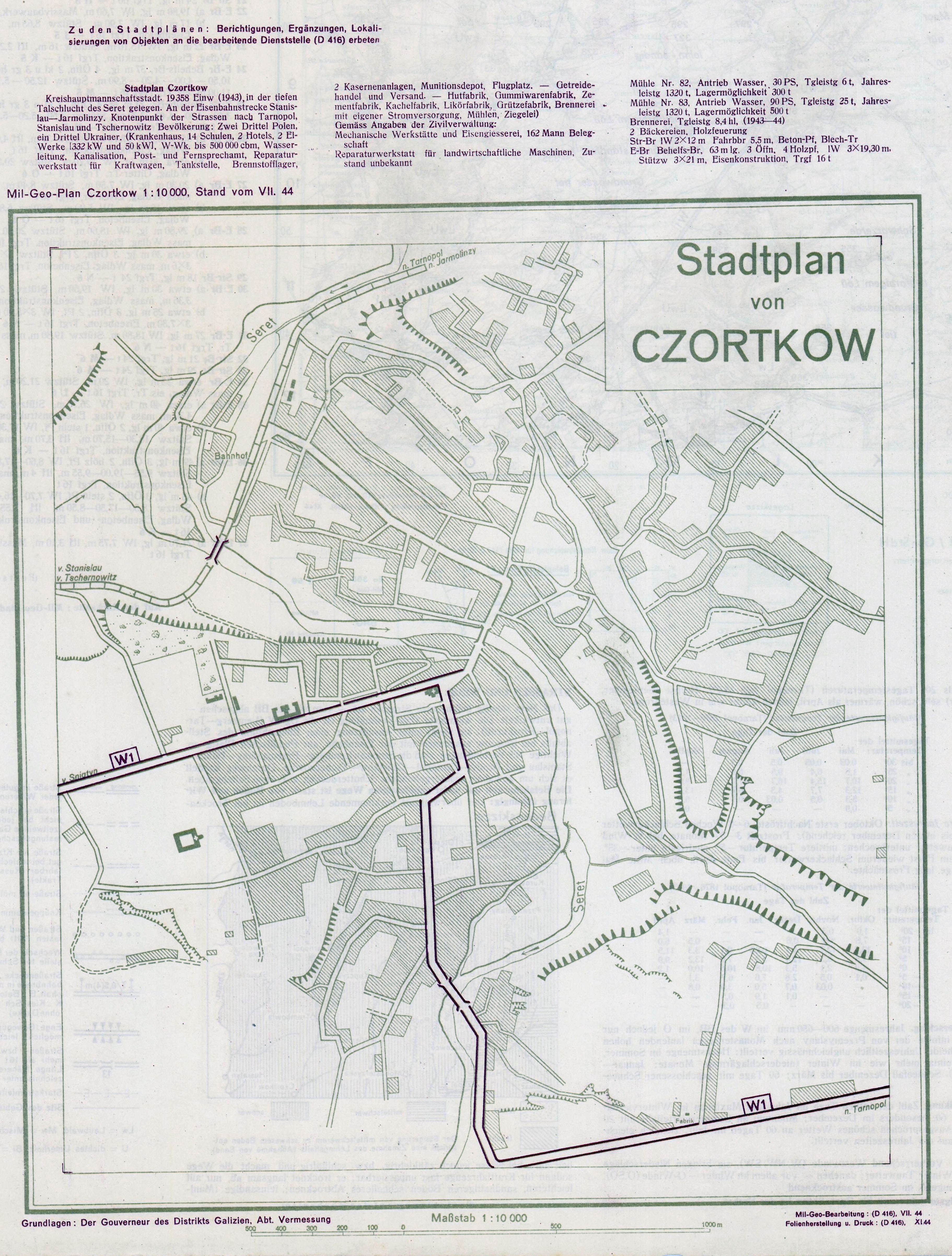
| Blattnummer | Czortków |
| Blattmaßstab | 1:10 000 |
| Blatttitel | Stadtplan von CZORTKOW |
| gegenwärtige Name | Чортків |
| alternative Name | Czortków |
| Veröffentlichungsjahr | 1944 |
| Hersteller | Abteilung für Kriegskarten und Vermeßungswesen |
| Scanauflösung | 300 dpi |
| Hinweise | Data wydania / publication date : VII.1944 Wydawca / publisher : IV MIL.-GEO Kolory / colours : 2 Skala / scale : 1:10 000 Opis / description : Interesujący, choć schematyczny plan wojskowo-geograficzny Czortkowa, aktualność podana na lipiec 1944 roku, druk listopad 1944 roku, podczas gdy miasto zajęte zostało przez armię radziecką już 23 marca 1944 r. Razem z planem Tarnopola, dostępnym poniżej, druk na odwrocie wojskowo-geograficznej wersji mapy „Osteuropa 1:300 000”, arkusz T50 Tarnopol (mapa dostępna w dziale „mapy niemieckie 1919 – 1945). Interesting, albeit simplified military-geograpic plan of the town of Czortkow, somewhat optimistically validity given as of July 1944, printed in Novembr 194, while the town itself was taken by the Soviet Army as early as mid-March 1944.; Together with a similar plan of the city of Tarnopol, it was printed on the reverse of a Mil-Geo 1:300,000 Osteuropa map (T50 Tarnopol, available in the German 1919 - 1945 maps sub-page |
| Datei hinzugefügt | 2012-10-14 |
| Eintrag editiert | 2012-10-14 23:40:30 |
| aus der Sammlung von | Archiwum Map WIG |
