


| map file | J32_Stanislawow_IWG_1922_300dpi.jpg |
|---|---|
| file size | 5818152 (5.5 MB) |
| sheet number | Row 39 Col 33 (A39 B33) |
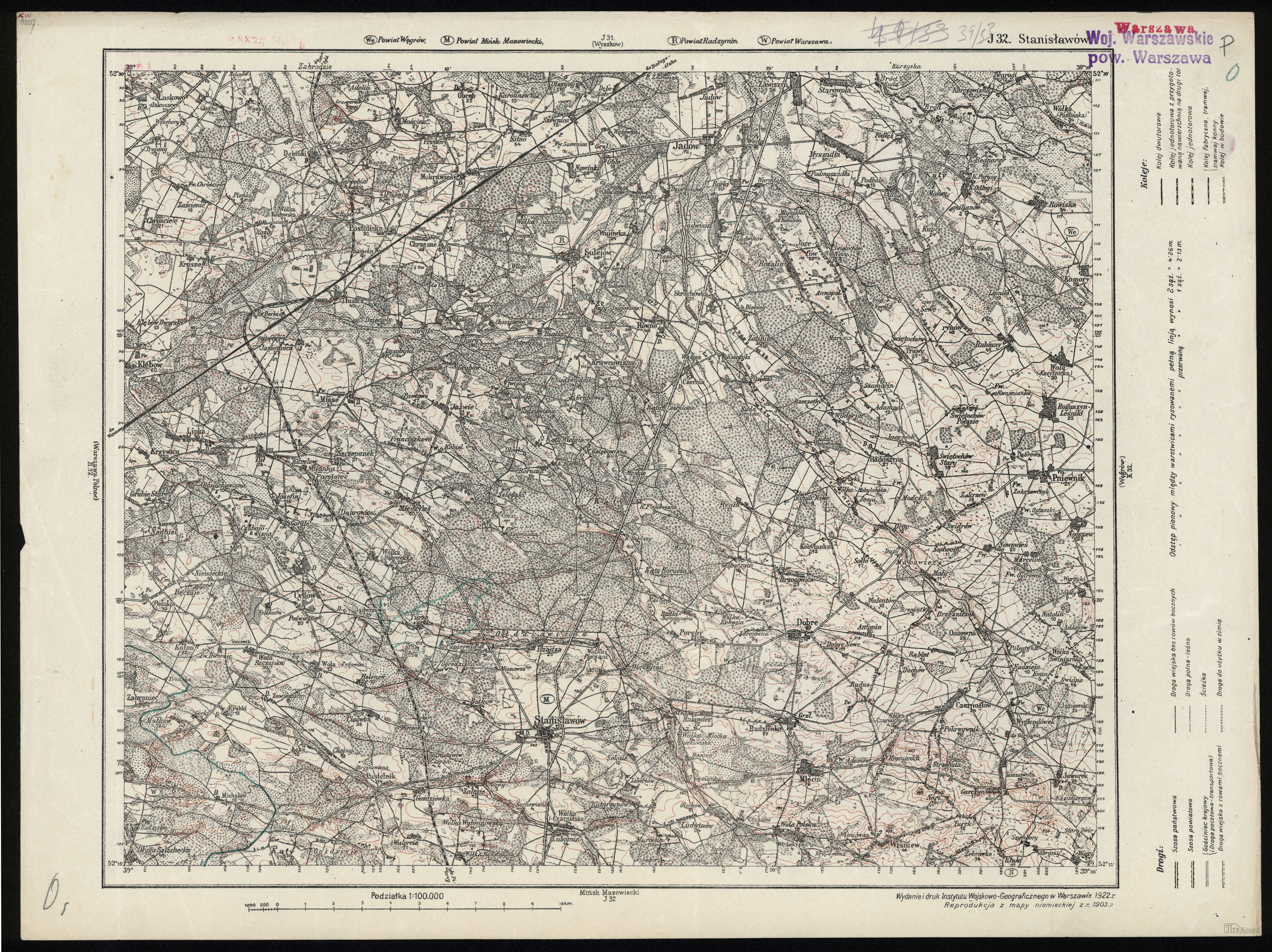
| sheet title | (J32) Stanisławów |
| modern name | Stanisławów |
| publication year | 1922 |
| publisher | Wojskowy Instytut Geograficzny |
| map type | Typ 0 |
| description | An early edition. The cartographic content is taken from German/Russian/Austrian maps. |
| map/scan condition | good |
| scan resolution | 300 dpi |
| scan colors | rgb |
| file added | 2012-11-20 |
| entry edited | 2012-11-20 17:59:06 |
| from the collection of | Piotr Kamiński |
