


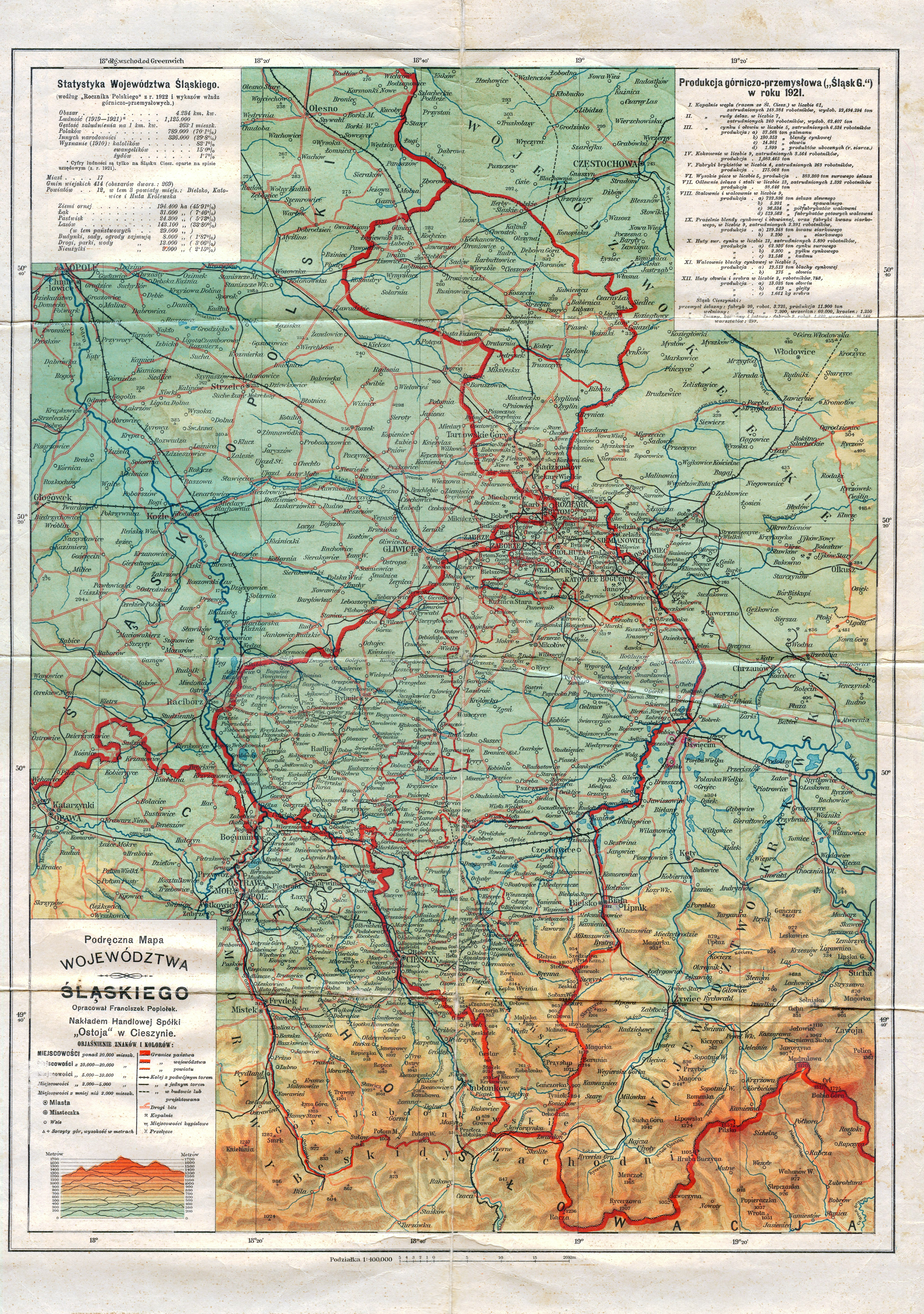
| map file | Podreczna_Mapa_WOJEWODZTWA_SLASKIEGO.jpg |
|---|---|
| file size | 7837308 (7.5 MB) |
| sheet number | POLREGIONS |
| sheet title | Podręczna mapa województwa śląskiego |
| modern name | A handheld map of the Voivodship of Silesia |
| publication year | ±1922 |
| scan resolution | 300 dpi |
| remarks | Opracował Franciszek Popiołek; Nakładem Handlowej Spółki “Ostoja” w Cieszynie |
| file added | 2013-04-28 |
| entry edited | 2013-04-28 12:04:23 |
| from the collection of | Archiwum Map WIG |
