


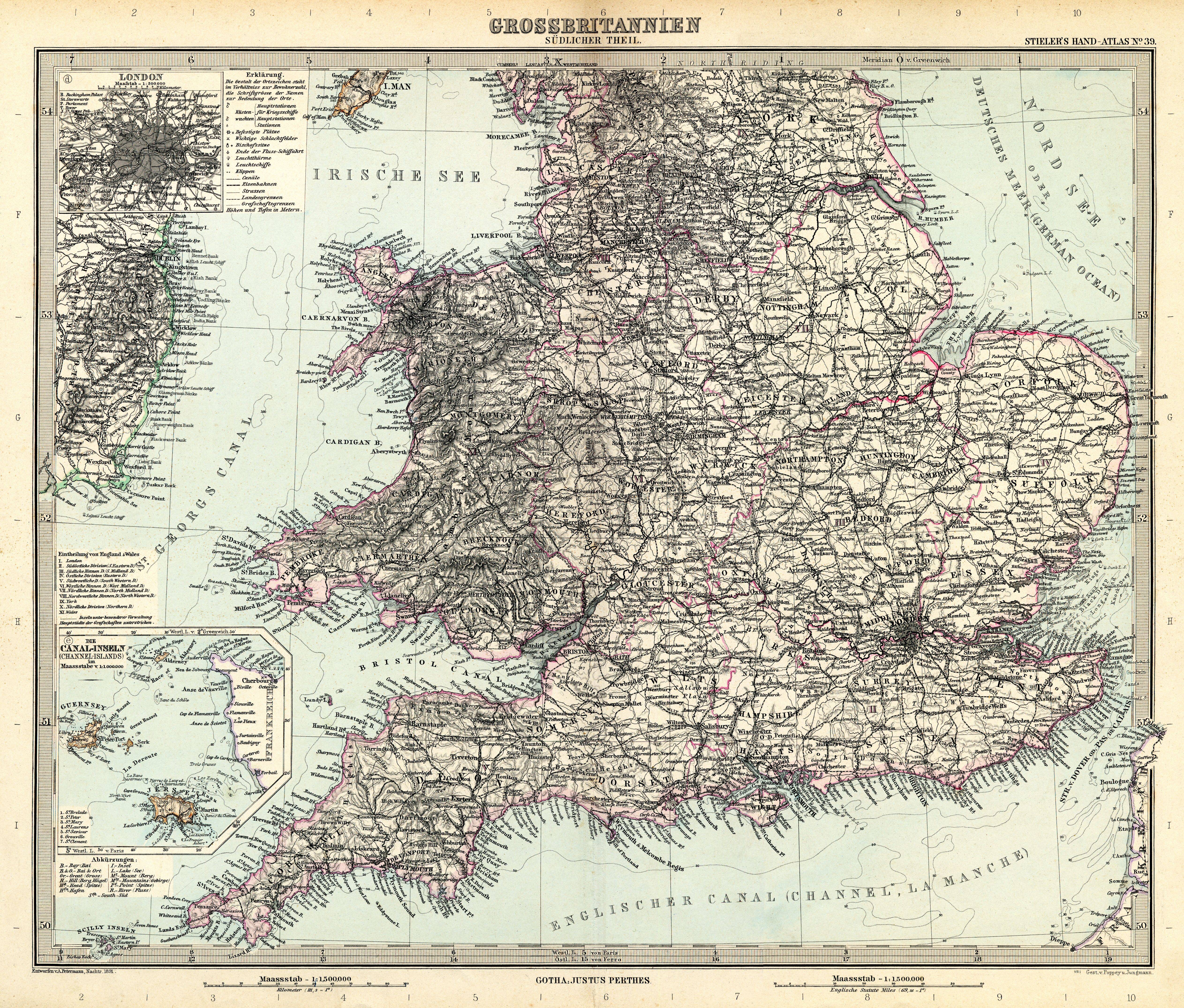
| map file | Stielers_Handatlas_1891_39.jpg |
|---|---|
| file size | 7039764 (6.7 MB) |
| sheet number | 39 |
| map sheet scale | 1:1,500,000 |
| sheet title | Grossbritanien südlicher Teil |
| modern name | Wielka Brytania, część południowa |
| publication year | 1891 |
| scan resolution | 300 dpi |
| remarks | Dodatkowe małe mapy na tym arkuszu: London 1:500000; Die Canal-Inseln (Channel-Islands) 1:1 000000 |
| file added | 2013-05-04 |
| entry edited | 2013-05-05 12:19:31 |
| from the collection of | Wikimedia Commons |
