


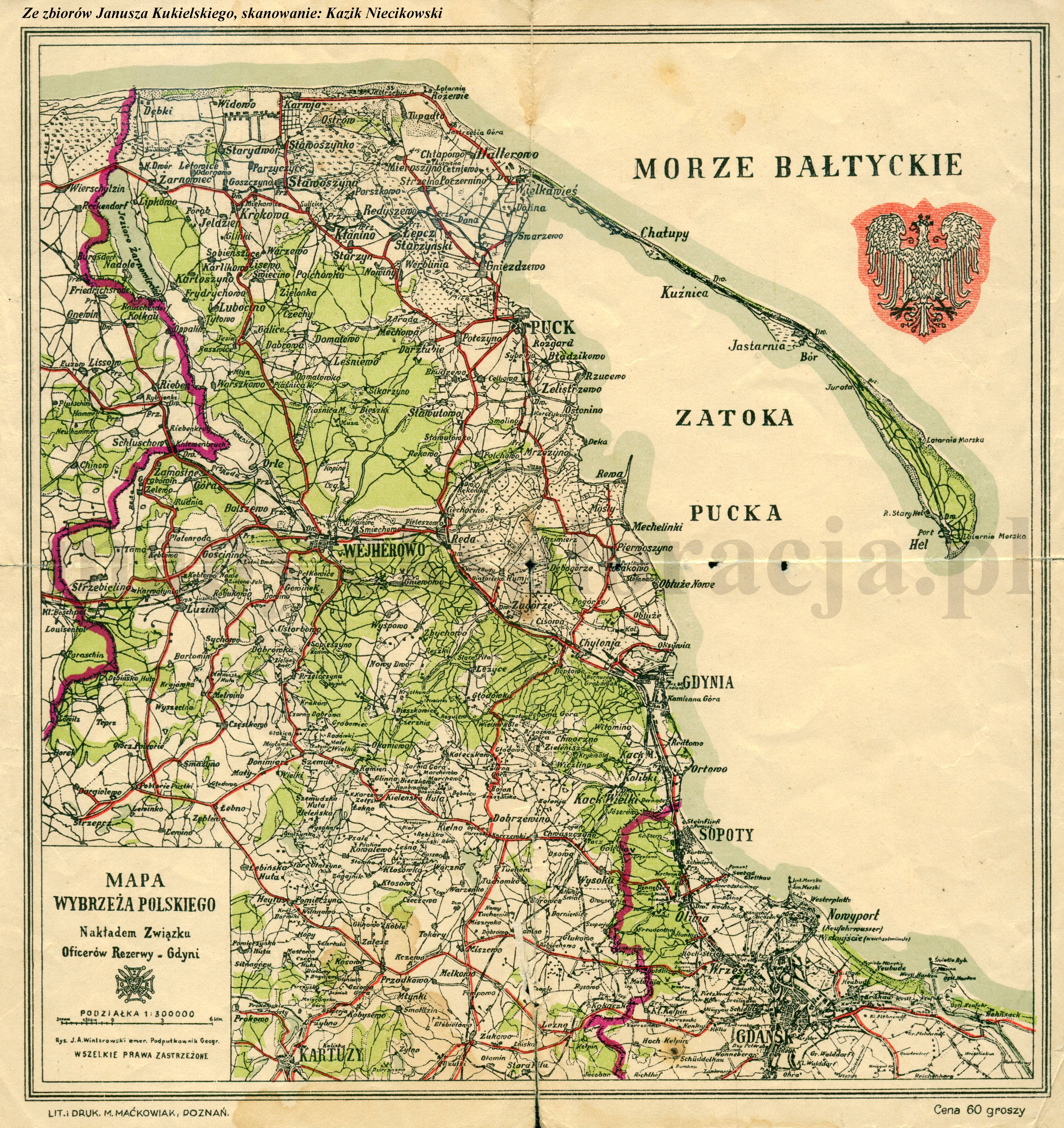
| Kartedatei | Mapa_wybrzeza_polskiego_300k_20te_ampg.jpg |
|---|---|
| Dateigröße | 4667619 (4.5 MB) |
| Blattnummer | POMORZE |
| Blattmaßstab | 1:300 000 |
| Blatttitel | Mapa wybrzeża polskiego |
| gegenwärtige Name | Map of the Polish seaside |
| Notiz | wyd. Związek Oficerów Rezerwy |
| Veröffentlichungsjahr | ±1925 |
| Scanauflösung | 300 dpi |
| Hinweise | Nakładem Związku Oficerów Rezerwy w Gdyni. Rys. J. A. Wintarowski emer. Podpułkownik Geogr. Published by the Union of Reserve Officers in Gdynia. Drawn by J. A. Wintarowski emeritus Lieutenant-Colonel Geographer |
| Datei hinzugefügt | 2013-05-14 |
| Eintrag editiert | 2013-05-14 20:17:29 |
| aus der Sammlung von | Archiwum Map Pomorza Gdańskiego |
