


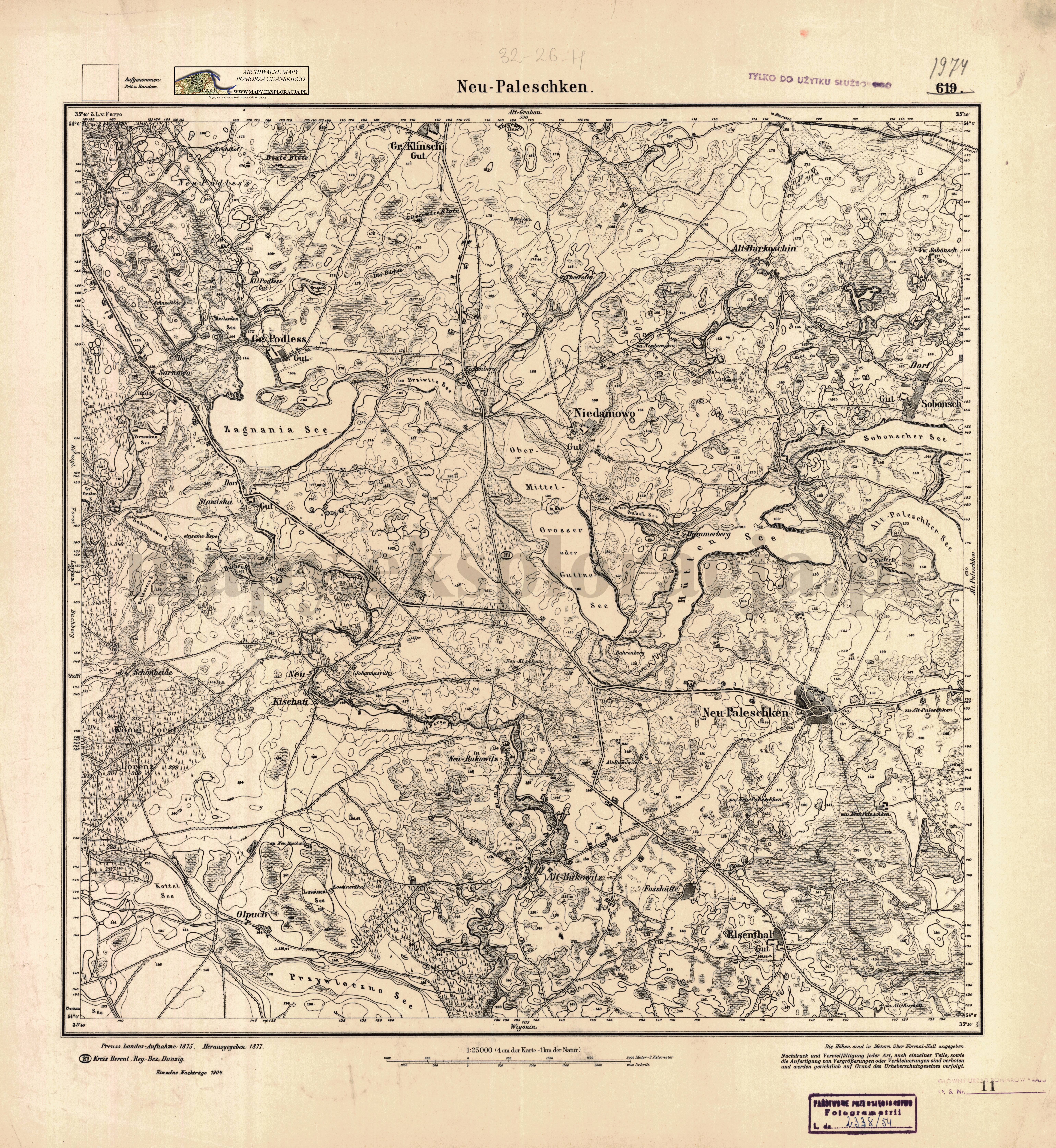
| map file | 1974_Neu_Paleschken_1904_300dpi_AMPG.jpg |
|---|---|
| file size | 6929097 (6.6 MB) |
| sheet number | 1974 (619) |
| sheet title | Neu Paleschken |
| modern name | Nowe Polaszki |
| publication year | 1904 |
| publisher | Königlich-Preussische Landesaufnahme |
| map type | Meßtischblatt 1877 A |
| description | Type of 1877. Without any grid, zero meridian Ferro. Sheet numbering system of the old type. A one-colour map. |
| field survey year | 1875 |
| last update year | 1904 |
| map/scan condition | good |
| scan resolution | 300 dpi |
| scan colors | rgb |
| entry edited | 2012-07-20 08:28:24 |
| from the collection of | Archiwum Map Pomorza Gdańskiego |
