


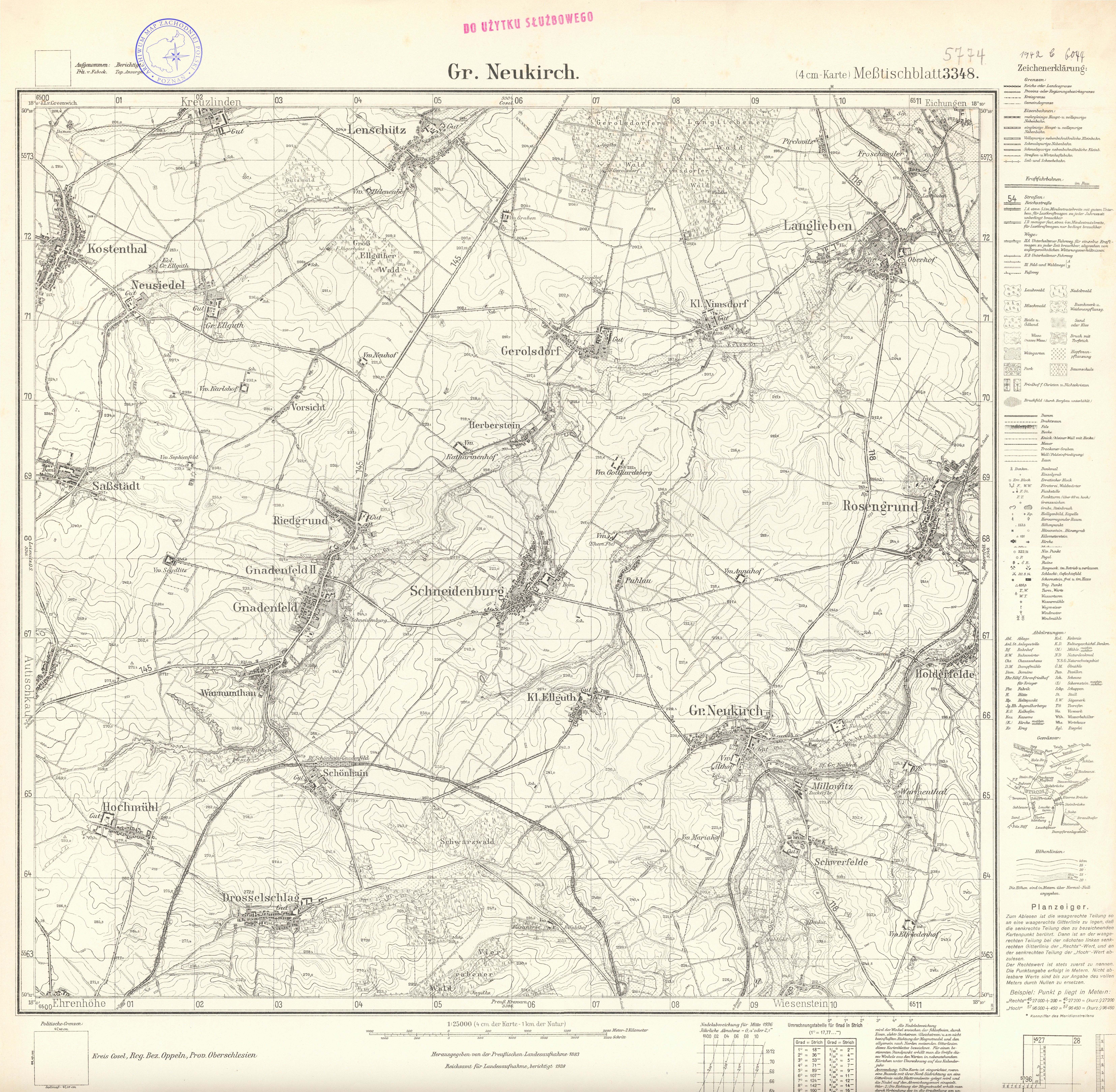
| map file | 5774_Gr_Neukirch_1936.jpg |
|---|---|
| file size | 8398855 (8.0 MB) |
| sheet number | 5774 (3348) |
| sheet title | Gr. Neukirch |
| modern name | Polska Cerkiew |
| publication year | 1936 |
| scan resolution | 300 dpi |
| entry edited | 2012-07-20 08:27:54 |
| from the collection of | Archiwum Map Zachodniej Polski |
