


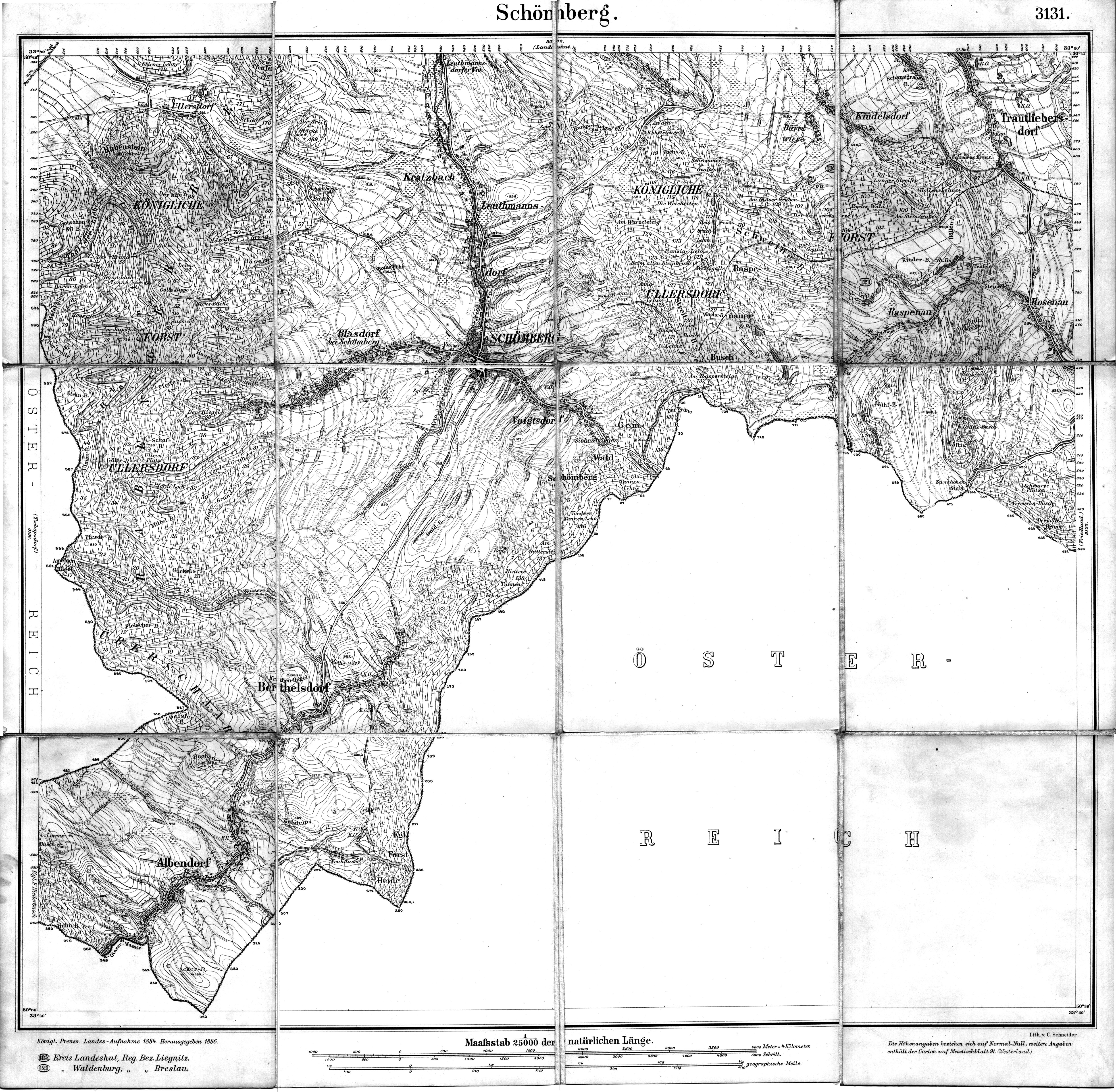
| map file | 5362_Schomberg_1886_Kartenmeister.jpg |
|---|---|
| file size | 5316396 (5.1 MB) |
| sheet number | 5362 (3131) |
| sheet title | Schömberg |
| modern name | Chełmsko Śląskie |
| publication year | 1886 |
| publisher | Königlich-Preussische Landesaufnahme |
| map type | Meßtischblatt 1877 A |
| description | Type of 1877. Without any grid, zero meridian Ferro. Sheet numbering system of the old type. A one-colour map. |
| map/scan condition | good |
| scan resolution | 200 dpi |
| scan colors | rgb |
| entry edited | 2012-07-20 08:30:37 |
| from the collection of | Kartenmeister |
